
Previous Story
Bing Maps Makes It Easier To See Map Features & Distinguish Park Trails From Streets
Posted On 31 May 2021
Comment: Off
Last Friday, Bing Maps announced new stylistic updates, designed to make its maps easier to read. Among the new style features, Bing has added more color gradient, adjusting the brightness of a land area depending on the zoom level. From the announcement: The land color will now be lighter when zoomed out and get darker […]
Last Friday, Bing Maps announced new stylistic updates, designed to make its maps easier to read.
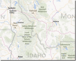
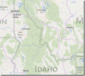
Among the new style features, Bing has added more color gradient, adjusting the brightness of a land area depending on the zoom level.
From the announcement:
The land color will now be lighter when zoomed out and get darker when zoomed in at higher levels of detail. Not only do these updates improve the overall aesthetic appeal of the maps, but they also help increase the contrast, making streets and other features more visible.
Bing Maps Color Gradient for Land Areas – Before and After:
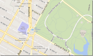
Bing also has made it easier to define a park trail or pathway versus an actual street, by making park trails and pathways less defined on the maps.
Bing Maps Differentiates Park Trails from Streets – Before and After:
Other Bing Maps updates include new landmark icons, with a broader selection of culturally-accurate symbols to define a location, and the removal of duplicate public transit icons for its US maps.